Autonomous Vehicle & Prototype Tracking: Fleet Visibility for AV Test Programs
An autonomous vehicle program at scale manages 50-500+ prototype vehicles. Each one carries $200K-$15M in sensors, compute hardware, and proprietary software. These vehicles move between R&D facilities, closed test tracks, supplier sites, regulatory testing locations, and sometimes public roads.
The fleet ops team is supposed to know where every vehicle is at all times. In practice, they maintain spreadsheets updated by email, walk parking lots to do physical counts, and call facility managers to confirm arrivals. When a prototype doesn't show up where it's expected, the scramble to find it burns hours and triggers security reviews.
This page covers how passive BLE tracking solves the fleet visibility problem for autonomous vehicle programs, defense vehicle fleets, and automotive R&D operations.
The Prototype Fleet Problem
What AV Test Fleets Look Like
Autonomous vehicle programs operate across multiple facility types with vehicles at different stages of development:
| Facility Type | Purpose | Typical Vehicle Count | Security Level |
|---|---|---|---|
| R&D headquarters | Hardware integration, software development | 20-100+ | High (badge access, NDAs) |
| Closed test tracks | Controlled environment testing, validation | 10-50 per track | Medium-High |
| Public road test zones | Real-world driving data collection | 20-200+ deployed | Medium |
| Supplier/partner facilities | Component integration, calibration | 5-20 at each | Varies |
| Regulatory test sites | Federal/state certification testing | 5-15 per session | Medium |
| Storage/staging yards | Idle vehicles, maintenance queue | 10-50 | Low-Medium |
A single AV program might have vehicles spread across 8-15 locations at any given time. Defense programs add secure storage facilities, military test ranges, and contractor sites to the mix.
Why Prototype Vehicles Are Different from Production Fleets
Standard fleet tracking assumes vehicles that look alike, run predictable routes, and can be fitted with any aftermarket device. Prototype vehicles break every one of those assumptions.
Each vehicle is unique and irreplaceable. Prototype #47 might have a different sensor configuration than #48. Sending the wrong vehicle to a calibration appointment wastes the appointment and the transport logistics. A Level 4 AV prototype with a full sensor stack (lidar, radar, cameras, compute) represents $500K-$2M in hardware alone, plus the months of software tuning specific to that vehicle's configuration.
IP exposure is the real risk, not theft. Nobody is stealing a prototype vehicle to sell it. The risk is unauthorized access, photography, or data extraction. A prototype sitting unaccounted-for at the wrong facility, even briefly, triggers security incident reports and audits. For defense programs, it can trigger ITAR violation reviews.
Cellular devices are a security concern. GPS trackers with SIM cards maintain active cellular connections. In programs handling ITAR-controlled technology, proprietary sensor data, or pre-release vehicle designs, adding an internet-connected device to the vehicle introduces an attack surface. Security teams push back on cellular trackers for exactly this reason.
Cost of Losing Track of a Prototype
The financial impact of poor fleet visibility compounds across several categories:
| Impact Category | Cost per Incident | Frequency |
|---|---|---|
| Wrong vehicle sent to test session | $5,000-$20,000 (transport + lost test time) | 2-4x per quarter |
| Missed calibration appointment | $3,000-$10,000 (rescheduling + downtime) | 1-3x per quarter |
| Security incident review (vehicle unaccounted for) | $10,000-$50,000 (staff time, documentation) | 1-2x per year |
| ITAR/compliance audit finding | $50,000-$500,000+ (remediation, potential fines) | Rare but catastrophic |
| Prototype damage from improper storage | $20,000-$200,000 (sensor replacement) | 1-2x per year |
| Duplicate R&D work (data from wrong vehicle) | $50,000-$500,000 (wasted engineering hours) | Hard to quantify |
A program running 100 prototype vehicles that avoids just two wrong-vehicle transport incidents and one security review per year recovers the entire cost of tracking within the first quarter.
Why Passive BLE Tracking Fits Sensitive Programs
AirTags use Bluetooth Low Energy. No cellular modem. No SIM card. No Wi-Fi radio. No GPS receiver. The device emits a rotating Bluetooth identifier picked up by nearby iPhones in the Apple Find My network, which relay the location to Apple's servers encrypted end-to-end.
This architecture has specific properties that matter for AV and defense programs:
| Property | AirTag (BLE) | Cellular GPS Tracker |
|---|---|---|
| Cellular radio | None | Active SIM, always connected |
| RF signature | Short-range BLE only | Cellular + GPS + sometimes Wi-Fi |
| Remote access possible | No | Yes (by design) |
| Data stored on device | None | Often stores location history |
| Network infrastructure required | None (uses existing iPhones) | Cellular coverage |
| Detectable by RF sweep | Minimal BLE signal | Easily detected |
| Monthly cost | $11.99/device (Airpinpoint) | $30-$50/device typical |
| Battery life | ~1 year (CR2032, no charging) | Days to weeks (needs charging/hardwiring) |
For a security team evaluating tracking devices for a classified or ITAR-controlled program, the difference between "passive BLE beacon with no network connection" and "always-on cellular device with remote access capabilities" is significant.
Fleet Scenarios
Scenario 1: Multi-Facility R&D Program
A large OEM runs an AV program across headquarters in Detroit, a test track in Arizona, a sensor supplier in San Jose, and a compute partner in Austin. 80 prototype vehicles at various stages of development.
The problem: Vehicles transport between facilities on enclosed carriers. The R&D coordinator maintains a spreadsheet with planned locations, but reality drifts. Three vehicles supposed to be in Arizona are still in Detroit because the transport was delayed. Two vehicles at the supplier were supposed to return last week.
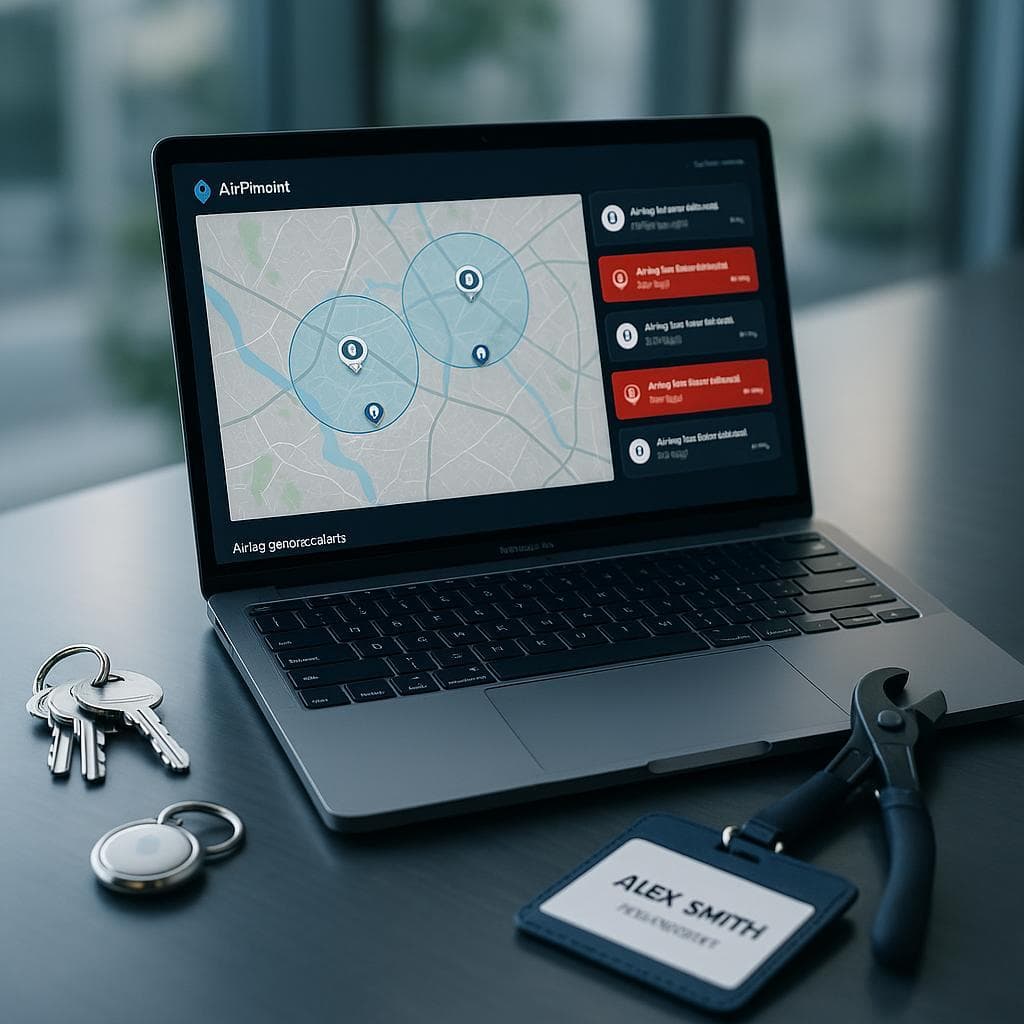
With Airpinpoint: Geofences around each facility. The dashboard shows 42 vehicles in Detroit, 18 in Arizona, 12 in San Jose, 6 in Austin, 2 in transit. The coordinator sees the three Arizona-bound vehicles are still in Detroit and adjusts the test schedule. The two overdue supplier vehicles show as still in San Jose, so they call the supplier to expedite.
Scenario 2: Defense Autonomous Vehicle Program
A defense contractor develops autonomous ground vehicles under a DoD contract. 30 vehicles across a contractor facility, two military test ranges, and a subcontractor site. ITAR applies to the vehicle platform and sensor systems.
The problem: The security office rejects cellular GPS trackers because they introduce an RF-emitting, internet-connected device onto ITAR-controlled hardware. Vehicle accountability relies on manual sign-out logs and periodic physical inventories. Discrepancies between logs and actual vehicle locations cause audit findings.
With Airpinpoint: BLE-only tracking devices with no cellular radio. The program manager sees all 30 vehicles on a single dashboard. Geofence alerts notify when vehicles arrive at or depart from each facility. Transport confirmations replace phone calls to receiving sites. The security office accepts the minimal RF footprint of a BLE beacon over a cellular tracker.
Scenario 3: Robotaxi Pre-Deployment Fleet
A robotaxi company preparing for commercial launch stages 200 vehicles across a maintenance depot, a mapping facility, a software update center, and three pre-deployment staging areas. Vehicles rotate between these locations as they receive hardware checks, software updates, and route mapping.
The problem: The ops team needs to know how many vehicles are at each stage of the deployment pipeline. A vehicle that's been sitting at the mapping facility for two weeks is a vehicle not generating revenue after launch. Manual tracking can't keep up with 200 vehicles moving through a multi-step pipeline.
With Airpinpoint: Each facility and staging area gets a geofence. The dashboard shows pipeline bottlenecks in real time. 40 vehicles backed up at the software update center? That's a capacity problem to fix before launch. The 8 vehicles that completed mapping but haven't moved to staging in 5 days? Those need attention.
Implementation for AV Programs
Phase 1: Facility-Level Visibility (Week 1)
Start with the highest-value problem: knowing which vehicles are at which facility.
- Purchase AirTags for all active prototype vehicles
- Establish naming convention (e.g., AV-P047, AV-D012 for platform/defense variants)
- Mount AirTags in a protected location inside each vehicle (glove box, under seat, trunk compartment)
- Register all vehicles in Airpinpoint
- Set up geofences for every facility, test track, and partner site
This immediately replaces spreadsheet-based tracking with live data.
Phase 2: Transport Monitoring (Week 2-3)
Configure geofence entry/exit alerts for transport confirmations:
- Vehicle departs origin facility (exit alert)
- Vehicle arrives at destination (entry alert)
- Vehicle sits at unexpected location for >24 hours (watchlist)
Route these alerts to the fleet ops team and relevant facility managers.
Phase 3: Security Integration (Week 3-4)
For programs with security requirements:
- After-hours movement alerts (any vehicle leaving a facility geofence outside business hours)
- Unauthorized facility alerts (vehicle appears at a location not on its approved list)
- Weekly reconciliation reports (dashboard vehicle count vs. expected count per facility)
Phase 4: Utilization Analysis (Ongoing)
Location history data reveals fleet utilization patterns:
- Which vehicles sit idle at storage for extended periods?
- Average turnaround time at each facility (maintenance, calibration, software updates)
- Transport frequency between facilities (optimize carrier scheduling)
- Seasonal patterns in test track utilization
Cost Comparison: Tracking a 100-Vehicle AV Fleet
Enterprise GPS Fleet Tracking
| Item | Cost |
|---|---|
| Hardware (100 devices @ $200 avg) | $20,000 |
| Monthly service (100 x $40/mo avg) | $4,000/mo |
| Installation labor (100 x $150) | $15,000 |
| Annual cost | $83,000 |
| 3-year total | $179,000 |
Plus: security review and approval process for adding cellular devices to prototype vehicles. Some programs will reject cellular trackers entirely.
Airpinpoint for Everything
| Item | Cost |
|---|---|
| AirTags (100 x $29) | $2,900 |
| Monthly service (100 x $11.99/mo) | $1,199/mo |
| Battery replacement (100 x $3/year) | $300/yr |
| Annual cost | $17,688 |
| 3-year total | $49,564 |
No installation labor. No security review for cellular devices. No charging infrastructure. Battery swap once a year.
The Real Savings
The hardware and subscription cost difference ($65K/year) is meaningful but secondary. The real savings come from:
- Eliminating 5-10 hours/week of manual vehicle location reconciliation
- Avoiding 2-4 wrong-vehicle transport incidents per quarter ($10K-$80K/year)
- Reducing security incident investigations from unaccounted vehicles
- Catching facility bottlenecks that delay test programs by days or weeks
For a program spending $100M-$1B annually on AV development, the tracking cost is a rounding error. The operational visibility is not.
The Autonomous Vehicle Industry Context
The autonomous vehicle market reached $86-274 billion in 2025 (estimates vary by scope) and is growing at 20-35% CAGR. Waymo alone operates 1,500+ vehicles across five US cities. Pony.ai runs 720+ robotaxis in China. Aurora launched commercial driverless trucking in 2025.
Every one of these programs manages prototype and pre-production vehicles that need fleet-level visibility. As the industry scales from hundreds to tens of thousands of vehicles in the next five years, manual tracking methods collapse. The programs that build fleet visibility infrastructure now, during the 50-500 vehicle phase, avoid painful retrofits later.
Honest Limitations
Not real-time telemetry. Airpinpoint provides fleet-level visibility (which facility, which city, arrived/departed). It does not provide second-by-second GPS coordinates, speed data, or route tracking. For operational telemetry during active testing, you need dedicated vehicle data acquisition systems.
Closed facility accuracy depends on staff density. At a busy R&D center with hundreds of employees carrying iPhones, location updates come frequently. At a remote proving ground with a skeleton crew, updates depend on how often someone walks past the vehicle. The system works best for facility-level tracking ("is the vehicle in Arizona or Detroit?") rather than precise parking-spot identification.
Not a replacement for vehicle data acquisition. Autonomous vehicles generate terabytes of sensor and driving data. Airpinpoint tracks physical location of the vehicle asset. It has no integration with the vehicle's onboard compute, sensor systems, or driving data pipeline.
Security approval required for classified programs. While BLE devices have a minimal RF footprint compared to cellular trackers, any electronic device brought into a classified or controlled environment requires security office approval. Airpinpoint is typically used for yard management and transport tracking, not inside classified work areas.
Why AV Programs Choose Airpinpoint
-
No cellular radio. The single biggest factor for defense and IP-sensitive programs. BLE-only means no SIM, no network connection, and no remote access surface.
-
Zero infrastructure. No base stations, no cellular coverage requirements, no charging stations. The Apple Find My network is the infrastructure, and it already exists everywhere your vehicles operate.
-
Multi-facility visibility. Purpose-built for tracking assets across 10+ locations simultaneously. One dashboard shows every vehicle at every facility.
-
Cost structure that scales. $11.99/device/month works whether you're tracking 20 vehicles or 500. No volume tiers, no enterprise pricing negotiations, no multi-year contracts.
-
5-minute deployment per vehicle. Place an AirTag, name it in the dashboard, set up geofences. No installation appointments, no wiring, no vehicle modifications.
Programs managing prototype vehicles worth millions in R&D investment need to know where those assets are at all times. Airpinpoint provides that visibility with a passive tracking device that security teams can approve, at a cost that doesn't require a budget review.