
Updated
Bluetooth vs GPS vs Cellular Tracking: Accuracy, Range, Battery, Cost
Location technologies split by one physics trade-off: precision costs power. GPS resolves to about 5 meters but needs a SIM and frequent charging. Bluetooth (BLE) resolves to 1 to 10 meters and runs for years on a coin cell because nearby phones do the heavy lifting. Cell tower triangulation reaches only 150 meters to several kilometers. Wi-Fi hits 5 to 15 meters indoors; UWB hits 10 to 30 centimeters. This page states the exact spec for each so you can match the technology to the asset.
Technology Comparison at a Glance
Every core spec, side by side. Accuracy figures are verified against GPS.gov for GPS and published RTLS research for BLE, Wi-Fi, cellular, and UWB (sources at the end).
| Technology | Typical accuracy | Works indoors? | Range | Battery draw | Needs SIM? | Per-unit cost | Best for |
|---|---|---|---|---|---|---|---|
| GPS / GNSS | ~5m open sky, 20m+ urban canyon | No | Global (needs sky + cell) | High (radio on up to 30s per fix) | Yes | $50-300 + plan | Vehicles, remote, theft recovery |
| BLE / Bluetooth | 1-10m proximity; 0.3-1m with 5.1 AoA | Yes (near phones/beacons) | Relies on network density, not tag range | Very low (microamp average) | No | $25-35 | Tools, urban equipment, indoor |
| Cellular (tower triangulation) | ~150m urban to several km rural | Partial | Anywhere with cell coverage | High per report | Yes | $30-150 + data | Coarse fallback for GPS trackers |
| Wi-Fi positioning | 5-15m (1-2m with RTT) | Yes | Building-scale near access points | Powered / moderate | No | Uses existing APs | Coarse indoor, office equipment |
| UWB (ultra-wideband) | 10-30cm | Yes | 10-50m per anchor | Moderate | No | Anchors + tags, high | Precision indoor (hospital, factory) |
| Apple Find My (BLE relay) | 1-10m (10-30m Bluetooth-only) | Yes (in populated areas) | Global via 2.5B Apple devices | Very low (coin cell 1-3 yr) | No | $25-35 tag | Business fleets, no SIM, no charging |
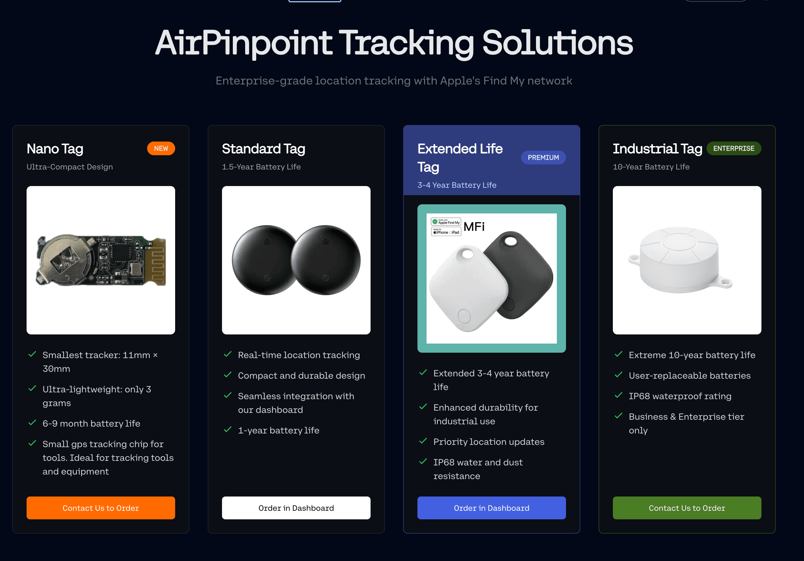
Airpinpoint uses Apple Find My. A BLE tag is relayed by nearby Apple devices, so tags need no SIM and no charging. You track them as a business fleet with location history, geofencing, and team access at $11.99 per device per month. The honest caveat: Find My is periodic, not continuous, and coverage depends on Apple devices passing nearby, unlike a cellular tracker that reports on its own schedule anywhere with signal. See business AirTag tracking.
Bluetooth vs GPS Tracker: The Direct Answer
A Bluetooth tracker has no GPS chip and no SIM. It broadcasts a short radio packet, nearby phones detect it, and their location becomes the tag's location, giving 1 to 10 meter accuracy where phones are dense and one to three years on a coin cell. A GPS tracker computes its own position to about 5 meters, then sends it over a cellular modem, which forces a SIM, a $10 to $45 monthly plan, and charging every few days to few months. Choose Bluetooth for cost, battery, and indoor coverage in populated areas; choose GPS for real-time position anywhere with sky view.
The split matters most for unpowered assets. A GPS tracker on a trailer, tool, or generator forces a choice between frequent updates and battery life, because each fix keeps the GPS radio on for up to 30 seconds and then powers a cellular modem. A Bluetooth tag sidesteps that entirely: the phone passing by pays the power and data cost. That is why one technology bills you monthly per unit and the other runs on a $1 battery.
GPS / GNSS Tracking
GPS resolves to about 5 meters under open sky (a 4.9m smartphone radius per GPS.gov), widens to 20 meters or more in urban canyons from signal reflection, and is unusable indoors. Range is global, but every position report requires two power-hungry steps: the GPS radio stays on up to 30 seconds to acquire satellites, then a cellular modem transmits over a mandatory SIM. Hardware runs $50 to $300 plus a $10 to $45 monthly plan. GPS is the only technology that gives continuous, precise position anywhere with sky view.
How it works
GPS receivers time signals from a constellation of 30+ satellites (GNSS covers GPS, GLONASS, Galileo, and BeiDou together) and solve for their own coordinates. The tracker knows exactly where it is, then transmits that fix to your platform over cellular. GPS supplies the position; the cellular modem supplies the connection.
Accuracy and range
- Open sky: about 5 meters (4.9m smartphone radius, under 3.5m for high-quality receivers)
- Urban canyon (tall buildings): 20 meters or more from multipath reflection
- Indoor: no fix or 50m+, satellite signals blocked by structure
- RTK GPS: centimeter-level with a ground reference station
- Range: global, wherever the device has both sky view and cellular coverage
Battery draw
GPS is power-hungry, and update frequency dominates the number. Real-time tracking drains a battery in one to seven days; one update per day stretches the same battery to two to three years. Fleet vehicles hardwire trackers to sidestep the constraint entirely.
| Update frequency | Battery life |
|---|---|
| Real-time (seconds) | 1-7 days |
| Every 5 minutes | 2-4 weeks |
| Every hour | 1-3 months |
| Motion-triggered | 3-6 months |
| ~1 update/day | 2-3 years |
| Hardwired | Unlimited |
Vendors advertising "3-year batteries" are quoting the one-update-per-day row, roughly 1,100 total location reports over the life of the cell. The metric that matters is updates per battery, not months of shelf life.
Cost
| Item | Cost | Frequency |
|---|---|---|
| Device | $50-300 | One-time |
| Installation | $50-150 | One-time |
| Cellular plan (SIM required) | $10-45 | Monthly |
| 3-year total | $460-1,920+ | Per device |
Best for
Vehicles (hardwired), theft recovery needing real-time response, remote assets with no phone network, and compliance use cases needing continuous audit trails.
BLE / Bluetooth Low Energy Tracking
BLE proximity resolves to 1 to 10 meters from signal strength, tightening to 0.3 to 1 meter with Bluetooth 5.1 Angle of Arrival and an antenna array. There is no GPS chip and no SIM: the tag broadcasts a short advertising packet at microamp-average current, and nearby phones supply the location, so a CR2032 coin cell lasts one to three years. Hardware is $25 to $35 with no mandatory carrier fee. BLE wins on battery, cost, and indoor coverage wherever phones are dense; it fails where no phones pass by.
How it works
Tags like AirTags, Tile, and Samsung SmartTags broadcast a small signal that nearby phones detect. The phone's own location is associated with the tag and reported to the owner. The tag never knows where it is. It relies on the crowdsourced network of phones to supply position, which is why battery draw stays at microamp-level averages.
Accuracy and range
- Proximity (RSSI): 1 to 10 meters, depending on phone or beacon density
- Bluetooth 5.1 direction finding (AoA/AoD): 0.3 to 1 meter with an antenna array
- UWB Precision Finding: 10 to 30 centimeters at close range
- Effective range: set by network density, not tag transmit power
In dense urban areas an AirTag can update within minutes. In rural areas, updates may take hours or never arrive, because the location comes from a passing phone, not the tag.
Battery draw
- AirTags: 12+ months on a CR2032 coin cell at full update rate
- Generic BLE beacons: 1 to 3 years typical
- Why: the tag only emits tiny advertising packets; nearby phones do the GPS fix and cellular upload on their own power
No charging, no wires, no maintenance for a year or more. Critically, that battery life is not bought by slowing updates. An AirTag in a city delivers 100,000+ location updates per cell, roughly 100x the total updates of a "3-year" GPS battery that updates once a day.
Cost
| Item | Cost | Frequency |
|---|---|---|
| Device | $25-35 | One-time |
| Carrier fee | None (no SIM) | n/a |
| Business platform | Airpinpoint from $11.99/tag | Monthly (optional) |
| Battery replacement | $2-5 | Every 1-3 years |
Low recurring cost is BLE's decisive advantage at volume. AirTags carry no Apple subscription; Airpinpoint adds the business dashboard, geofencing, and team access.
Best for
Tools and mid-value equipment, urban and suburban operations, indoor tracking where GPS fails, high-volume deployments where a per-unit cellular fee does not pencil out, and hidden backup tags on high-value items.
Limitations
- Network dependency: useless where no phones pass by (deep rural, remote sites)
- Periodic, not real-time: updates only when a device detects the tag
- Coarse without UWB: proximity gives correct area or building, not exact coordinates
Cellular IoT: LTE-M and NB-IoT
Cellular IoT uses mobile networks tuned for low-power devices. On its own, cell tower triangulation resolves only to about 150 meters in dense urban areas and several kilometers in rural areas, so most cellular trackers add a GPS chip for real position (about 5 meters) and use towers as a fallback. Battery life reaches up to 10 years, but only at low duty cycles (roughly daily) using Power Saving Mode and eDRX; at real-time rates the same device lasts days. A SIM and a $3 to $15 monthly data plan are mandatory.
How they work
- LTE-M (Cat-M1): higher bandwidth, supports voice and mobility, better for moving assets
- NB-IoT: lower power, tuned for stationary assets sending infrequent small packets
Both ride existing cellular towers with IoT-optimized protocols. Both provide the communication layer; GPS provides the positioning layer in most trackers.
Accuracy and range
- Cell tower triangulation: about 150 meters urban, several kilometers rural (RF triangulation generally cannot resolve under 150 meters)
- With GPS module: about 5 meters (most cellular trackers include one)
- Range: anywhere with cellular coverage
Battery draw
Power Saving Mode (device sleeps between transmissions) and eDRX (extends how long the device can go without listening, up to about 175 minutes) enable multi-year life. But the numbers assume infrequent updates.
| Technology | Battery life | Assumed update rate |
|---|---|---|
| NB-IoT | 5-15 years | Daily or less |
| LTE-M | 2-10 years | Infrequent to hourly |
A cellular IoT device updating every 5 minutes exhausts its battery in days to weeks, not years. Transmission frequency, not the radio, sets the lifespan.
Cost
| Item | Cost | Frequency |
|---|---|---|
| Device | $30-150 | One-time |
| Data plan (SIM required) | $3-15 | Monthly |
| 3-year total | $140-690 | Per device |
Best for
Container and supply-chain tracking across regions, agriculture and utilities over wide areas, and mobile assets where no phone crowd exists to relay BLE.
LTE-M vs NB-IoT
| Factor | LTE-M | NB-IoT |
|---|---|---|
| Best for | Mobile assets | Stationary assets |
| Bandwidth | Higher | Lower |
| Latency | Lower (better real-time) | Higher |
| Power use | Higher | Lower |
| Voice support | Yes | No |
LoRaWAN (Low Power Wide Area Network)
LoRaWAN reaches several kilometers rural and 1 to 3 kilometers urban on unlicensed radio, with 5 to 10+ year battery life at low update rates and no per-unit cellular fee on a private gateway. Position comes from a GPS module (about 5 meters) or, without GPS, from Time Difference of Arrival at 50 to 200 meters. It trades a gateway investment for zero recurring cost, which suits many assets confined to a defined area.
Accuracy and range
- GPS-equipped trackers: about 5 meters (most LoRaWAN trackers include GPS)
- TDoA without GPS: 50 to 200 meters
- Range: several kilometers rural, 1 to 3 kilometers urban
Battery draw
| Update frequency | Battery life |
|---|---|
| Every 15 minutes | 3-5 years |
| Hourly | 5-8 years |
| Daily | 10+ years |
Cost
| Item | Cost | Frequency |
|---|---|---|
| Device | $40-150 | One-time |
| Gateway (if private) | $150-1,000 | One-time |
| Public network fee | $0-5 | Monthly |
| Private network | $0 | Ongoing |
After the gateway investment, ongoing cost on a private network is zero, which makes LoRaWAN attractive for many assets in a fixed area (farm, campus, yard).
Best for
Agriculture, industrial sites, logistics yards, large campuses, and rural deployments beyond cellular coverage.
Limitations
- Infrastructure required: deploy gateways or access a public network
- Low bandwidth: 0.3 to 50 kbps, unsuitable for large data or firmware
- Periodic, not real-time: designed for scheduled updates
Indoor Tracking: Wi-Fi, BLE Beacons, and UWB
GPS does not work indoors. The three indoor options trade accuracy for infrastructure cost: Wi-Fi positioning reaches 5 to 15 meters reusing existing access points, BLE beacons reach 2 to 5 meters with dedicated beacons every 5 to 10 meters, and UWB reaches 10 to 30 centimeters with dedicated anchors. Pick Wi-Fi for coarse zone location at near-zero added hardware, BLE beacons for room-level accuracy, and UWB when centimeters matter.
Wi-Fi positioning
- How: signal strength from known access points; Wi-Fi RTT uses round-trip timing
- Accuracy: 5 to 15 meters typical, 1 to 2 meters with RTT
- Advantage: reuses existing access points, no new hardware
- Limitation: resolves to a zone or room, not a precise spot
BLE beacons (indoor)
- How: fixed beacons act as reference points for mobile tags
- Accuracy: 2 to 5 meters with adequate beacon density
- Placement: every 5 to 10 meters for best results
- Cost: $20 to $50 per beacon plus install
UWB (ultra-wideband)
- How: time-of-flight ranging between tag and anchors
- Accuracy: 10 to 30 centimeters, best available indoors
- Limitation: requires dedicated anchor infrastructure, highest cost
- Best for: manufacturing, healthcare, high-precision needs
Comparison
| Technology | Accuracy | Infrastructure cost | Best for |
|---|---|---|---|
| Wi-Fi | 5-15m (1-2m RTT) | None (existing APs) | Coarse indoor zone |
| BLE beacons | 2-5m | Medium | Warehouse, retail |
| UWB | 10-30cm | High | Precision requirements |
Real-Time vs Passive Tracking
Real-time tracking transmits position continuously and needs a cellular plan and more power, fitting vehicles and high-value mobile assets. Passive tracking reports only when scanned or detected by a network, costs little or nothing to run, and lasts years, fitting tools, indoor inventory, and low-value items. The choice is not accuracy, it is whether you need current position or last-known position.
Real-time (active)
- Technologies: GPS + cellular, LTE-M, NB-IoT
- Pros: know exactly where an asset is now, immediate theft response, geofencing with instant alerts
- Cons: higher power (shorter battery), mandatory cellular plan ($10-45/month), higher per-unit cost
- Best for: vehicles, high-value mobile assets, theft-prone equipment
Passive
- Technologies: barcodes, QR, passive RFID, BLE crowdsourced tags
- Pros: low or no recurring cost, long or no battery, simple to deploy at scale
- Cons: no live position, location is last-known, coarser
- Best for: static assets, indoor inventory, tools, low-value items
Hybrid (most fleets)
| Asset type | Tracking method | Rationale |
|---|---|---|
| Vehicles | Hardwired GPS | Real-time required, no battery concern |
| Heavy equipment | GPS + hidden BLE backup | Recovery plus backup if GPS is pulled |
| Power tools ($500+) | BLE tag | Low cost, works in populated areas |
| Hand tools | Checkout + spot tags | Accountability without tagging everything |
| Indoor assets | RFID or BLE beacons | Cost-effective in controlled space |
Decision Framework: Match Technology to Asset
By environment
| Environment | Technology | Why |
|---|---|---|
| Urban outdoor | BLE tag | Dense phone network relays updates |
| Rural outdoor | GPS or LoRaWAN | No phone crowd; GPS works anywhere with sky |
| Indoor (existing Wi-Fi) | Wi-Fi positioning | Reuses access points, 5-15m |
| Indoor (precision) | UWB or dense BLE beacons | 10-30cm or 2-5m |
| Mixed indoor/outdoor | BLE tag + GPS on vehicles | Cover both without a SIM on every item |
By asset value
| Asset value | Technology | Cost logic |
|---|---|---|
| Under $500 | Barcode/QR or BLE tag | Tracking cost must stay under asset value |
| $500-$5,000 | BLE tag | Low cost, no SIM, works in populated areas |
| $5,000-$25,000 | GPS or BLE (density-dependent) | GPS if remote, BLE if urban |
| Over $25,000 | GPS + BLE backup | Full visibility plus redundancy |
By industry
| Industry | Primary | Secondary |
|---|---|---|
| Construction | BLE tags + GPS on vehicles | Tool checkout system |
| Fleet / logistics | Hardwired GPS | BLE tags on trailers |
| Agriculture | LoRaWAN or LTE-M | Long range, minimal infrastructure |
| Retail / warehouse | RFID or BLE beacons | High volume, controlled space |
| Healthcare | UWB or BLE RTLS | Precision indoor required |
Total Cost of Ownership: 100 Assets Over 3 Years
The recurring fee, not the hardware, drives cost at fleet scale. A SIM per device turns a $30 tracker into a four-figure three-year cost; a BLE tag with an optional business plan stays an order of magnitude lower.
| Solution | Hardware | Monthly | 3-year total | Per asset |
|---|---|---|---|---|
| BLE tags only | $2,900 | $0 | $3,200* | $32 |
| Basic GPS | $10,000 | $1,500 | $64,000 | $640 |
| Premium GPS | $20,000 | $3,500 | $146,000 | $1,460 |
| LoRaWAN (private) | $15,000** | $0 | $15,000 | $150 |
| Hybrid* | $8,500 | $600 | $30,100 | $301 |
*Includes battery replacements. **Includes gateways and trackers. ***GPS on 20 high-value assets, BLE tags on 80 others.
The Bottom Line
There is no single best tracking technology, only the best fit for a given asset and environment. Choose GPS when you need real-time position anywhere with sky view, and accept the SIM, the plan, and the charging. Choose BLE (AirTags) when assets sit in populated areas, you are tracking many lower-value items, and you want no carrier fee and years of battery. Choose cellular IoT or LoRaWAN for wide-area assets needing multi-year battery at low update rates. Most fleets mix them, and the mix is usually GPS on the few vehicles plus BLE tags on the hundreds of tools where a monthly cellular fee per unit never pays back.
Airpinpoint runs the BLE path as a business platform. Tags ride Apple Find My (a BLE tag relayed by nearby Apple devices), so there is no SIM and no charging, and you manage them as a fleet with location history, geofencing, and team access at $11.99 per device per month. The tradeoff to weigh: Find My is periodic and depends on Apple devices passing nearby, where a cellular tracker reports continuously on its own schedule. For tools and mid-value equipment in populated areas, that tradeoff favors BLE by a wide margin. Track AirTags as a business fleet.
Sources
- GPS accuracy: GPS.gov, GPS Accuracy (about 4.9m smartphone radius under open sky; under 3.5m for high-quality receivers)
- Cell tower triangulation: Accuracy Characterization of Cell Tower Localization and RF triangulation floor of about 150m
- BLE proximity and AoA: A Practice of BLE RSSI Measurement for Indoor Positioning (PMC) and Bluetooth 5.1 AoA calibration research (0.3-1m with direction finding)
- Wi-Fi positioning: Wi-Fi Indoor Positioning Systems (5-15m RSSI, 1-2m RTT)
- UWB accuracy: UWB RTLS vs BLE, GNSS, Wi-Fi & GSM (10-30cm)
- Cellular IoT battery: How eDRX and PSM Extend Battery Life in LTE-M and NB-IoT (up to 10 years at low duty cycle)


 Our Solution