Livestock GPS Tracker: Tracking Cattle, Horses & Breeding Stock on Ranch Operations
Cattle prices hit record levels in 2024 and keep climbing. Bred heifers sell for $3,500-$5,000+ depending on genetics and region. A single registered bull can be worth $10,000-$50,000. When individual animals carry that kind of value, knowing where they are stops being optional.
GPS tracking for livestock has existed for years, but it's been expensive and complicated. Dedicated cattle collars from companies like Digitanimal, Nofence, and LoneStar Tracking cost $150-$329 per device plus monthly subscriptions. For a ranch tracking 50 breeding cows, that's a $7,500-$16,000 upfront investment before the first subscription payment.
AirTag-based tracking through Airpinpoint offers a cheaper entry point at $29/tag + $11.99/device/month. But it comes with a real limitation: AirTags depend on nearby iPhones, and iPhones are scarce on remote rangeland. This page breaks down when each approach makes sense, what it actually costs, and where the coverage gaps are.
Why Ranchers Are Tracking Livestock
Cattle Theft Is Not a Relic
Cattle rustling sounds like an 1880s problem. It's not. The Texas & Southwestern Cattle Raisers Association (TSCRA) employs 30 Special Rangers who investigate roughly 1,000 agricultural crime cases per year and recover an average of $5 million in stolen cattle and assets annually. In March 2025, a TSCRA investigation led to arrests in an 82-head cattle theft spanning six ranches across Texas and Oklahoma.
California ranchers lose an average of 1,900 head per year, with an estimated $1.5 million in direct losses. Only about half of stolen animals are ever recovered. Nebraska reported 454 head missing or stolen in 2023 alone. Montana reported 177, North Dakota 74, South Dakota 71.
These are just reported cases. Many ranchers don't file reports for small losses because the paperwork isn't worth the time when three heifers disappear from a back pasture.
Modern rustlers don't ride horses. They pull up with stock trailers at 3 AM, load cattle from remote pastures, and sell them at a sale barn two states away before the rancher even notices they're gone. Some alter brands or remove ear tags to obscure ownership.
With commercial cattle at $2,000-$3,000 per head and bred cows at $3,500-$5,000+, a single truckload of 20 stolen cattle represents $40,000-$100,000 in losses.
Fence Break Detection
A downed fence line at 2 AM means cattle on the highway by sunrise. Beyond the value of the cattle themselves, loose livestock on roads creates serious liability. A collision between a vehicle and a 1,200-pound cow at 55 mph is often fatal for both.
Geofenced pastures with GPS-tracked cattle give you an immediate alert when animals cross a boundary. Whether it's a fallen tree, a broken post, or a gate left open, you know about it in minutes instead of discovering it during the next pasture check.
BLM Grazing Allotment Compliance
The Bureau of Land Management administers nearly 18,000 grazing permits across more than 21,000 allotments on federal land. Permit holders must manage livestock consistent with federal regulations, including keeping cattle within designated allotment boundaries and following prescribed grazing schedules.
GPS tracking provides documentation that cattle stayed within allotment boundaries during the permitted season. This is especially valuable during permit renewals or if disputes arise with the BLM about grazing compliance.
Calving Season Monitoring
During calving season, knowing where a cow is can mean the difference between a live calf and a dead one. First-calf heifers in particular may need assistance, and finding them quickly in a 2,000-acre pasture matters. GPS tracking narrows the search from "somewhere on the ranch" to a specific GPS coordinate.
Predator Response
USDA data shows cattle and calf losses from predators totaled roughly 220,000 head in 2010 (the most recent comprehensive survey), costing ranchers $98.5 million. Coyotes account for about a third of predator kills. In states with recovering wolf populations, wolf-cattle conflicts add another layer of concern.
When a tagged animal hasn't moved for an extended period or is in an unusual location, it may indicate injury or a predator kill. Early detection means faster response, which can save the carcass for insurance documentation and protect the rest of the herd.
Dedicated Livestock GPS Trackers
If your cattle graze remote rangeland with minimal human traffic, dedicated GPS trackers are the right tool. These devices use cellular networks or satellite constellations to transmit location data directly, without relying on nearby smartphones.
Digitanimal
Digitanimal makes a GPS collar for cattle, sheep, goats, and horses. The collar weighs 265 grams, operates in temperatures from -40F to 158F, and transmits location data every 30 minutes. Battery life is approximately one year.
Beyond GPS coordinates, Digitanimal detects heat cycles and potential calving events through activity pattern analysis. The platform includes geofencing, herd movement analytics, and multi-user access.
Pricing requires contacting Digitanimal directly, but industry reports put the hardware at approximately $150-$200 per collar with a monthly subscription for the data platform.
Nofence
Nofence takes a different approach: virtual fencing. Cattle wear GPS collars ($329/collar for cattle, $229 for sheep/goats) that define grazing boundaries through the app instead of physical fence wire. When an animal approaches the virtual boundary, the collar emits audio warnings. If the animal continues, it delivers a mild electric pulse similar to a standard electric fence.
The first 12 months of subscription are included with the collar purchase. After that, subscriptions renew yearly or monthly depending on your grazing season length.
Nofence is primarily a grazing management tool, but the GPS tracking data it generates is valuable for theft detection, fence-break alerts, and herd monitoring.
LoneStar GSatSolar
The GSatSolar uses the Globalstar LEO satellite constellation instead of cellular networks. This means it works almost anywhere on the planet, including deep backcountry with zero cell coverage. The tracker weighs 29 grams, measures 2.2 inches, and includes solar charging. Location updates transmit as frequently as every hour.
Hardware includes 3 years of satellite service. Pricing requires contacting LoneStar directly.
Cost Comparison: Dedicated Trackers for a 50-Head Breeding Herd
| Solution | Hardware Cost (50 units) | Year 1 Subscription | Year 1 Total | Year 2+ Annual |
|---|---|---|---|---|
| Digitanimal | $7,500-$10,000 | $3,000-$6,000 | $10,500-$16,000 | $3,000-$6,000 |
| Nofence (cattle) | $16,450 | Included | $16,450 | $3,000-$9,000 est. |
| LoneStar GSatSolar | Contact for pricing | Included (3 years) | Contact for pricing | Contact for pricing |
These are serious investments. For operations with high-value registered cattle, breeding stock worth $10,000-$50,000 per head, or cattle on remote allotments where a single loss event can cost $50,000+, dedicated trackers make financial sense.
AirTag-Based Tracking Through Airpinpoint
How It Works
An AirTag attached to a cattle collar broadcasts a Bluetooth signal. Any iPhone within about 30 feet picks up that signal and anonymously relays the AirTag's location to Apple's Find My network. Airpinpoint then pulls that location data into a ranch management dashboard with geofencing, history, alerts, and multi-user access.
The Coverage Question (Be Honest With Yourself)
This is the most important section on this page. AirTags do not have GPS. They do not have cellular radios. They cannot transmit their location on their own. They are entirely dependent on nearby iPhones to relay their position.
Where AirTags work well for livestock:
- Horse farms and boarding facilities (people with iPhones around daily)
- Feedlots and livestock auction yards
- Ranches near small towns, county roads, or highways
- Cattle in transit on trailers (highways have steady iPhone traffic)
- Pastures adjacent to residential areas or public roads
- Operations where ranch hands carry iPhones during daily work
Where AirTags struggle:
- Remote BLM allotments miles from any road
- Mountain grazing above 8,000 feet with no cell coverage
- Large properties (10,000+ acres) where cattle are miles from any road or structure
- Winter range in isolated desert or plains with no traffic
If your closest neighbor is 15 miles away and your cattle graze on a 20,000-acre BLM allotment in central Nevada, AirTags will not track them. Full stop. You need a cellular or satellite GPS tracker.
If your cattle graze 500 acres along a county road in central Texas, with a farmstead, several neighbors, and a small town 5 miles away, AirTags will update multiple times per day and geofence alerts will fire within minutes of a boundary crossing.
Most ranch operations fall somewhere between these extremes. Be honest about your specific geography before investing.
What Airpinpoint Adds
Apple's Find My app shows one dot per AirTag on a map. That's fine for finding your keys. It's useless for managing livestock.
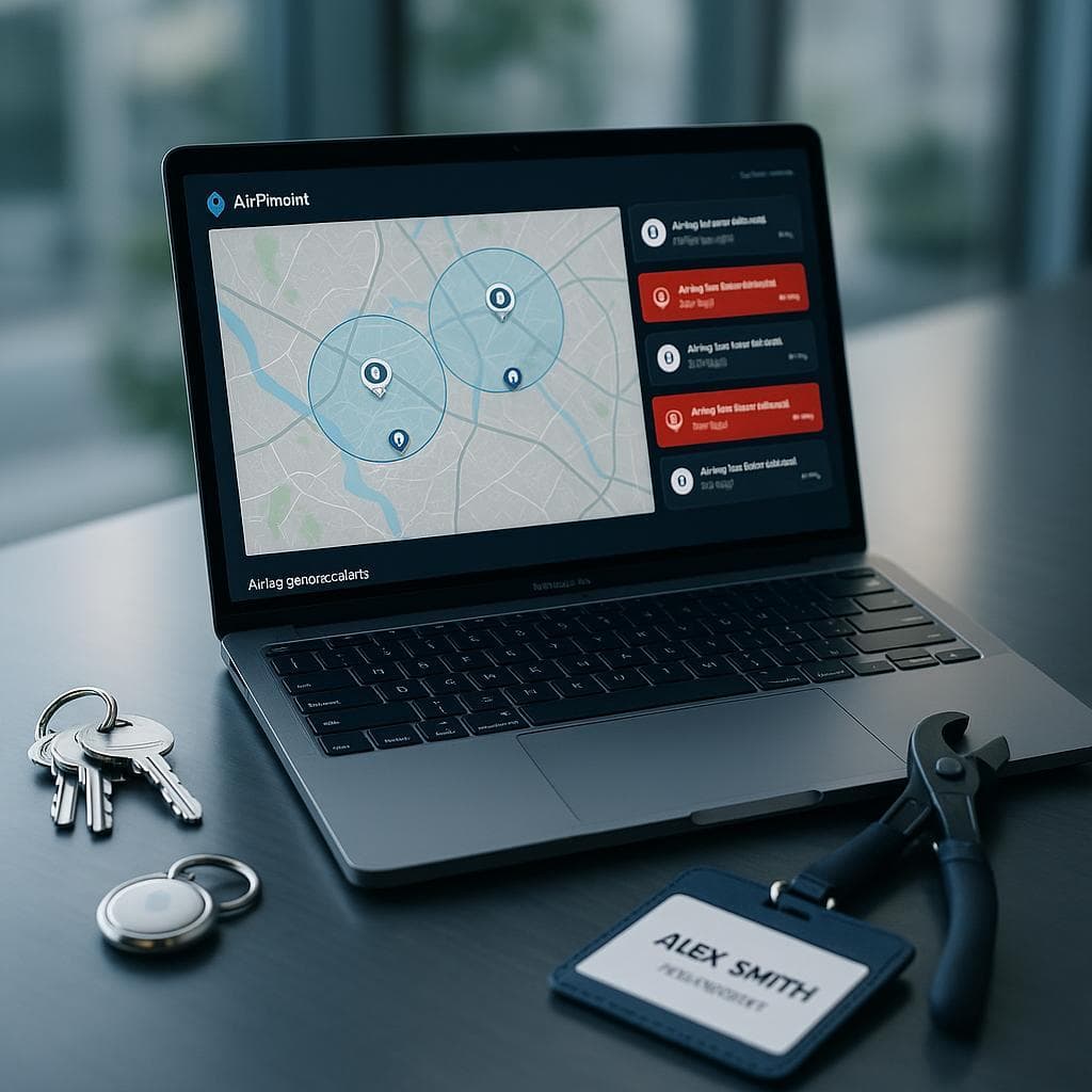
Airpinpoint gives ranch operations:
Herd dashboard. All tagged animals on a single map. Filter by pasture, tag group, or last-seen time. See which animals haven't reported a location in 24+ hours (may indicate a dead zone, lost tag, or problem).
Pasture geofencing. Draw polygon boundaries around each pasture. Get alerts when any animal crosses a boundary. This catches fence breaks, open gates, and theft attempts faster than any visual check.
Location history. See where each animal has been over days, weeks, or months. Identify grazing patterns, preferred areas, and movement corridors. Useful for rotational grazing planning and documenting BLM allotment compliance.
Multi-user access. Ranch owner, foreman, and hands all see the same dashboard. When an alert fires at 2 AM, whoever is on call can respond with location data already on their phone.
Automated alerts. Configure alerts for boundary crossings, extended periods without location updates, or unusual movement patterns. Alerts go to multiple team members simultaneously.
Cost: Airpinpoint for Livestock
| Herd Size | AirTags (one-time) | Airpinpoint Annual (Business) | Year 1 Total | Year 2+ Annual |
|---|---|---|---|---|
| 10 breeding cows | $290 | $1,439 | $1,729 | $1,439 |
| 25 breeding cows | $725 | $3,597 | $4,322 | $3,597 |
| 50 breeding cows | $1,450 | $7,194 | $8,644 | $7,194 |
| 100 head (mixed herd) | $2,900 | $14,388 | $17,288 | $14,388 |
You don't need to tag every animal. For theft detection and fence-break alerts, tagging 10-20% of the herd is often enough. If one tagged cow crosses a geofence, the others probably did too. For a 200-head commercial operation, tagging 20-40 lead cows covers your alert needs at a fraction of the cost of tracking every animal.
For breeding stock where individual animals are worth $5,000-$50,000, tag every one.
Enterprise pricing
Operations with 200+ devices should contact Airpinpoint for custom volume pricing that brings per-device costs down significantly from the standard Business rate.
Practical Setup for Ranch Operations
Mounting Options
Neck strap collar mount (recommended for cattle): Attach a waterproof AirTag case (Catalyst, Pelican, or similar IP68-rated case) to a standard cattle neck strap using heavy-duty zip ties, rivets, or a sewn leather pouch. Position the AirTag on the top of the neck where it's less likely to snag on brush or feeders.
Ear tag holder: Several companies make AirTag-compatible ear tag holders that clip onto existing NLIS/RFID ear tags or attach directly. These are lower profile but harder to access for battery replacement.
Halter mount (horses): For horses, attach the AirTag case to the halter crown piece or cheek strap. Many horse operations keep halters on pastured horses anyway, making this a natural attachment point.
Battery Management
AirTag batteries (CR2032) last approximately one year. For a ranch operation, schedule battery replacement during a routine gather. Spring processing (when you're already running cattle through the chute for vaccinations and branding) is a natural time to swap batteries.
Keep a stock of CR2032 batteries on hand. Buy in bulk from Amazon or a farm supply store. Per-battery cost drops below $1 when purchased in 50-packs.
Durability Considerations
AirTags are IP67 rated (submersion to 1 meter for 30 minutes). In a proper waterproof case, they survive rain, creek crossings, mud, and freezing temperatures without issue. The bigger concern is physical impact and UV exposure. Use a case that provides:
- Hard shell protection against impacts (cattle rub against posts, trees, and each other)
- UV-resistant housing (direct sun degrades most plastics within a year)
- Secure mounting that won't pull free during normal cattle behavior
Replace cases annually during battery swap if they show UV degradation or cracking.
Where Airpinpoint Fits Best
Horse Farms and Boarding Facilities
Horse operations are the strongest use case for AirTag livestock tracking. Horses are individually valuable ($5,000-$100,000+ for performance and breeding stock), properties are typically closer to populated areas with good iPhone density, and owners visit daily providing consistent Bluetooth proximity.
Tag every boarded horse. Set up pasture and property geofences. Give each horse owner read access to their animal's location through multi-user sharing. This doubles as a service differentiator for boarding operations.
Feedlots and Sale Barns
Feedlots are in populated areas with steady iPhone traffic from employees, truck drivers, and visitors. Track high-value pens, incoming loads, and hospital pen animals. Sale barns can verify animal locations during consignment.
Small to Mid-Size Cow-Calf Operations Near Towns
A 500-acre cow-calf operation with frontage on a county road and a small town within a few miles. This is the sweet spot. iPhone traffic from passing vehicles and nearby residents keeps AirTag locations current. Geofence alerts catch fence breaks and theft attempts reliably.
Cattle in Transit
Stock trailers on highways pass hundreds of iPhones per hour. AirTags in transit update constantly. This is useful for verifying cattle arrivals at sale barns, feedlots, or new pastures. It also creates a movement record for brand inspectors and traceability documentation.
What Airpinpoint Cannot Do
Transparency matters more than a sale. Airpinpoint is not the right solution for:
- Remote rangeland tracking. Cattle on BLM allotments 30 miles from the nearest road will not report locations through AirTags. Use Digitanimal, LoneStar GSatSolar, or Nofence.
- Real-time continuous tracking. AirTags update when an iPhone passes by, not on a fixed schedule. You might get updates every 10 minutes near a road or every 6 hours in a quiet pasture. Dedicated GPS collars transmit on a set interval (every 30-60 minutes).
- Health and behavior monitoring. Dedicated livestock collars from Digitanimal and others track activity levels, detect heat cycles, and predict calving. AirTags only report location.
- Virtual fencing. Nofence collars keep cattle within boundaries using audio and electric cues. AirTags only tell you after an animal has left.
If you need any of these capabilities, pay for the dedicated hardware. The extra cost is justified.
Hybrid Approach: Best of Both
Some operations use both technologies. Tag your 20-30 most valuable registered breeding animals with dedicated GPS collars for guaranteed coverage anywhere on the ranch. Tag the remaining commercial herd with AirTags through Airpinpoint for cost-effective fence-break detection and theft alerts in areas with reasonable iPhone traffic.
This gives you the reliability of cellular/satellite GPS where it matters most (individual $10,000+ animals) and the cost efficiency of AirTags for herd-level monitoring.
Comparing All Options
| Feature | Airpinpoint + AirTags | Digitanimal | Nofence | LoneStar GSatSolar |
|---|---|---|---|---|
| Hardware cost/unit | $29 | ~$150-$200 | $329 | Contact for pricing |
| Monthly cost/unit | $11.99 | ~$5-$10 | Varies by volume | Included (3 yrs) |
| Works in remote rangeland | No | Yes (cellular) | Yes (cellular) | Yes (satellite) |
| Works near roads/towns | Yes | Yes | Yes | Yes |
| Battery life | ~1 year | ~1 year | Solar recharging | Solar recharging |
| Geofencing | Yes | Yes | Yes (virtual fencing) | Yes |
| Heat/calving detection | No | Yes | No | No |
| Multi-user dashboard | Yes | Yes | Yes | Yes |
| Best for | Near-town operations, horse farms, feedlots, transit | Mid-size ranches with cell coverage | Rotational grazing, virtual fencing | Remote/backcountry, BLM allotments |
Getting Started
-
Assess your coverage. Walk or drive your property with an iPhone running the Find My app. Drop an AirTag in each pasture for a week and see how often it updates. If you're getting multiple updates per day, AirTag tracking will work. If updates are every 2-3 days, you need dedicated GPS.
-
Start small. Tag 10 high-value animals. Set up pasture geofences. Run it for a month. Evaluate alert speed, location accuracy, and whether the coverage meets your needs.
-
Scale based on results. If coverage is good, expand to the full breeding herd. If certain pastures have poor coverage, consider dedicated GPS collars for animals that graze those areas.
-
Plan battery replacement. Add "swap AirTag batteries" to your spring processing checklist. Order CR2032 batteries in bulk ahead of time.
For operations with 200+ head, contact Airpinpoint for enterprise pricing and a coverage assessment of your specific property.