The Future of Asset Inventory Management: Zero-Touch Automation in 2025
Every inventory system in history has had the same weak point: a human being who has to scan something. Barcodes needed a person with a gun. RFID needed a person to walk assets past a reader, or a budget for readers at every door. The interesting development of the last few years is systems where asset status is derived from location rather than from an action someone remembers to take.
This guide covers that progression honestly: what each generation solved, what it didn't, and what "zero touch" actually means once you get past the slide deck. Airpinpoint's version derives status from geofence presence, and this guide is specific about the latency and accuracy you get in exchange for never scanning anything.
Table of Contents
- The Evolution of Asset Inventory Management
- RFID Inventory Tracking: The Current Standard
- The Game-Changer: GPS-Based Automated Asset Management
- Implementing Zero-Touch Inventory Management
- ROI Analysis: The Business Case for Automation
- Case Studies: Organizations Transforming Through Automation
- Future Developments on the Horizon
- FAQs: Automated Inventory Management Systems
The Evolution of Asset Inventory Management
The journey toward automated inventory management has evolved through distinct technological phases, each solving limitations of previous approaches:
Phase 1: Manual Inventory Management (Pre-2000s)
- Paper-based tracking systems
- Physical counts and manual record-keeping
- Accuracy that decayed between counts, with no way to measure by how much
- Labor-intensive processes
Phase 2: Barcode Revolution (2000-2010)
- Introduction of barcode scanning technology
- Semi-automated data entry
- Accuracy that held exactly as well as scanning discipline held
- Still required manual scanning of each item
The structural problem with barcodes was never the technology, it was the incentive. A scan is an action a person has to choose to perform, usually at the end of a shift, usually when they want to go home. Any system whose accuracy depends on a tired person doing an optional extra step degrades toward the effort people are willing to spend, which is why barcode inventories drift out of true between audits rather than all at once.
Phase 3: RFID Transformation (2010-2020)
- Implementation of RFID inventory tracking systems
- Passive detection of multiple items simultaneously
- High accuracy at the reader, and no visibility at all between readers
- Reduced but still necessary human intervention
RFID solved the discipline problem by taking the person out of the read. What it could not solve was economics. The accuracy lives at the reader, so your visibility is exactly as good as your reader coverage, and readers are capital expenditure. A warehouse with one loading door is cheap to instrument. Fifteen rotating job sites are not, which is why RFID never reached mobile field equipment despite being the better technology at any single chokepoint.
Phase 4: GPS Automation (2024-Present)
- Location-derived status rather than scan-derived status
- Geofences standing in for the doorway reader, without the doorway hardware
- Check-in and check-out inferred from where an asset is, not from an action someone took
- No scanning step, and therefore nothing for a tired crew to skip
- A different failure mode from the previous generations: not human error, but coverage gaps and latency
This evolution represents the industry's progression toward frictionless, accurate, and efficient asset inventory management systems.
RFID Inventory Tracking: The Current Standard
RFID inventory tracking systems have become the backbone of modern inventory management over the past decade, with solid benefits but inherent limitations:
How RFID Inventory Systems Work
RFID technology uses radio waves to identify and track tags attached to objects. A typical RFID inventory management system includes:
- RFID Tags: Attached to inventory items, containing unique identifiers
- RFID Readers: Installed at strategic locations to detect tag movement
- Middleware: Software that processes and interprets tag data
- Inventory Management Software: System that updates inventory records based on tag movement
Advantages of RFID Inventory Systems
| Advantage | Description | Business Impact |
|---|---|---|
| Simultaneous Scanning | Multiple items detected at once | A pallet reads in one pass instead of item by item |
| Non-Line-of-Sight Reading | Tags can be read without visual contact | Improved scanning reliability and speed |
| Durability | Tags withstand harsh environments | Lower replacement costs than barcodes |
| Data Capacity | Store more information than barcodes | Enhanced asset data management |
| Real-Time Tracking | Continuous monitoring of tagged items | Improved inventory accuracy |
Limitations of RFID Systems
Despite their advantages, RFID inventory tracking systems have noteworthy constraints:
- Limited Range: Typically 1-30 feet depending on tag type
- Gateway Dependence: Requires fixed reader infrastructure
- Metal/Liquid Interference: Signal disruption from certain materials
- Infrastructure Costs: Significant reader installation expenses
- Partial Automation: Still requires some human intervention
- Indoor Focus: Limited effectiveness in large outdoor areas
These limitations have created demand for the next evolution in asset inventory management: GPS-based automated systems.
The Game-Changer: GPS-Based Automated Asset Management
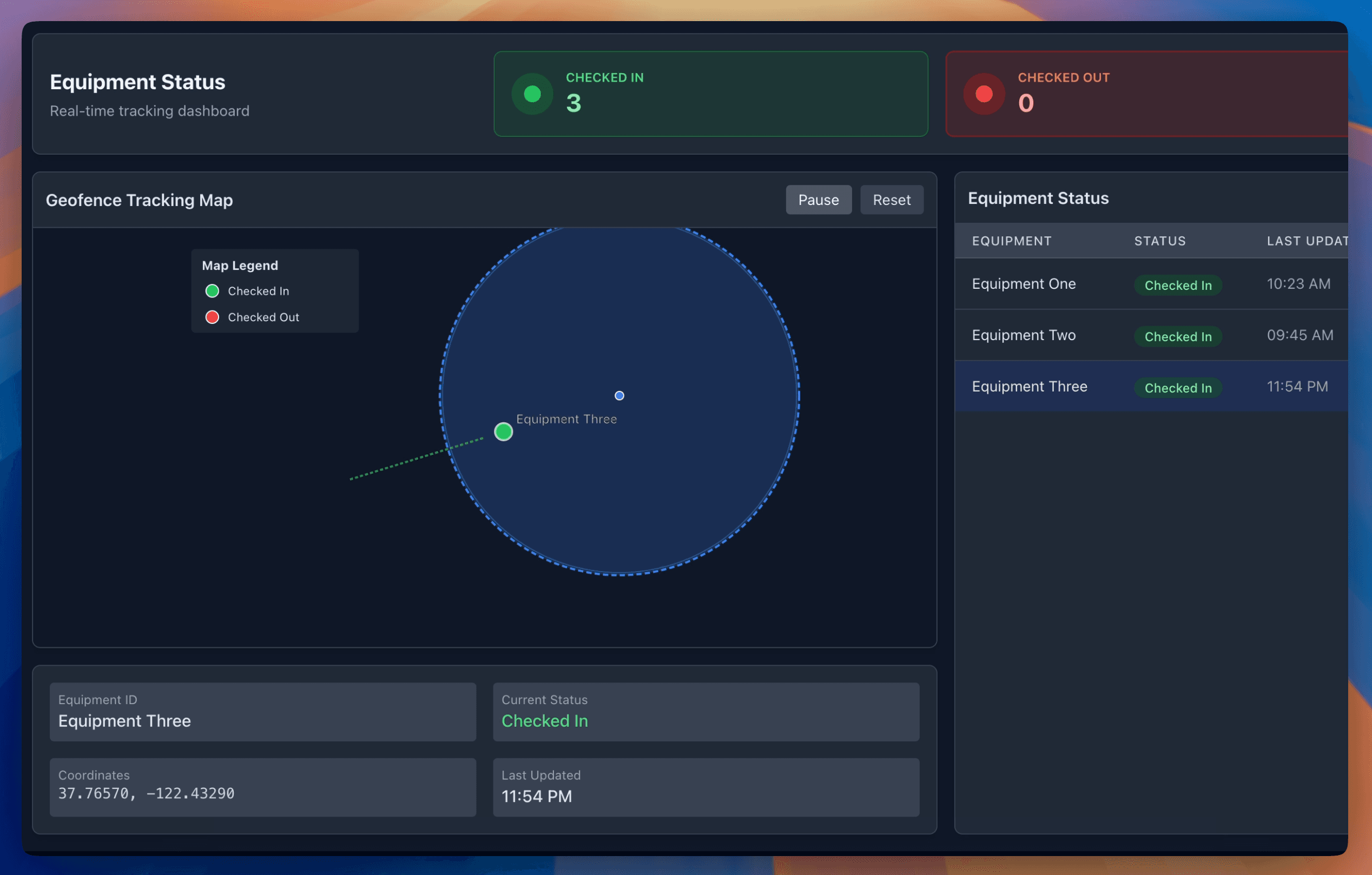
The latest revolution in asset inventory management integrates GPS tracking technology with geofencing to deliver truly zero-touch automation:
How Automated GPS Asset Management Works
- GPS-Enabled Asset Tags: Small trackers attached to valuable assets
- Geofence Definitions: Virtual boundaries established around storage areas, job sites, or facilities
- Cloud-Based Monitoring: Real-time location awareness and boundary monitoring
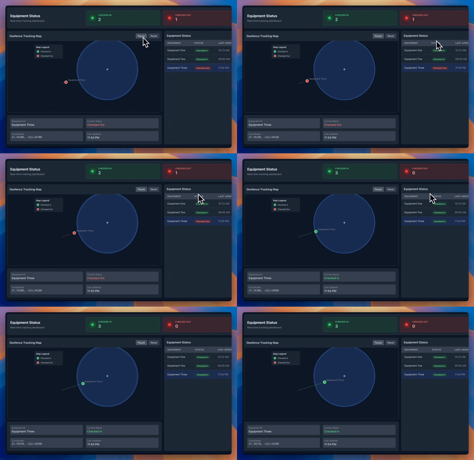
- Automated Status Updates: System automatically registers check-in/check-out events when assets cross geofence boundaries
- Notification System: Alerts for unauthorized movements or schedule deviations
The Zero-Touch Revolution
Modern GPS-based inventory systems eliminate the need for any manual scanning or human intervention in the check-in/check-out process:
- Assign an asset one or more home geofences, and its status in the inventory list is derived from whether it currently sits inside one
- An asset that leaves its home zone reads as out; one that returns reads as back, with nobody scanning anything
- Location history is retained for audit and dispute analysis, exportable as CSV or JSON
- Utilization is computed from the check-out log rather than estimated
- Geofence entry and exit fire outbound webhooks plus email, Slack or WhatsApp alerts
Two things this does not do, and both matter for planning. It does not trigger maintenance scheduling from usage metrics: a Find My tag has no link to a machine's hours, so usage-based servicing is not available at any price on this hardware. And it is not instantaneous. Airpinpoint requires consecutive readings outside a boundary before treating a crossing as real, which means a confirmed geofence event typically lands 15 to 40 minutes after the asset actually moved. That threshold exists because a single stray position fix would otherwise page someone at 3am every week.
The honest way to frame this generation is a trade, not an upgrade. You give up the certainty of a scan, which is exact and instant at the moment it happens, and you get continuous passive coverage that nobody has to remember. Whether that's a good trade depends entirely on whether your assets live where people are.
Comparative Analysis: Barcode vs. RFID vs. GPS Automation
| Feature | Barcode | RFID | Airpinpoint Automation |
|---|---|---|---|
| Employee Intervention | High (manual scanning) | Medium (gateway monitoring) | None for status, once home geofences are set |
| Real-Time Location | No | Limited (at chokepoints) | Wherever an Apple device passes near the tag |
| Range | Line of sight only | 1-30 feet | Anywhere the Find My network reaches |
| Installation Complexity | Low | High (fixed infrastructure) | Low (no readers, no gateways, no site wiring) |
| Location Accuracy | Exact at the scan point | Exact at the reader | Roughly 10 to 30 meters |
| Status Latency | Instant at scan | Instant at the reader | 15 to 40 minutes on a geofence crossing |
| Outdoor Effectiveness | Poor | Limited | Good where people are, poor where they aren't |
| Cost Per Asset | $0.05-0.15 per label | $0.10-5.00 per tag | $29 per tag, one time |
| Recurring Cost Per Asset Per Month | Labor only | Labor plus reader maintenance | $11.99 |
| Infrastructure Cost | Low | High | None |
Read the accuracy and latency rows carefully, because they're the two that vendors in this category tend to leave off. Scan-based systems know exactly where an asset was at a precise instant and nothing about it in between. Geofence-derived status knows roughly where an asset is most of the time, and cannot tell you which shelf. Neither is strictly better. A parts room with a single door is genuinely well served by RFID. A fleet of equipment moving between fifteen sites is not, at any reader budget.
Implementing Zero-Touch Inventory Management
Transitioning to an automated inventory management system requires strategic planning and implementation:
1. Assess Asset Value and Mobility
Determine which assets justify GPS tracking based on:
- Financial value
- Operational importance
- Mobility requirements
- Loss/theft risk
- Utilization monitoring needs
High-value assets with frequent movement are ideal candidates for GPS-based automation.
2. Select Appropriate Tracking Technology
Choose tracking technology based on specific requirements:
- Active GPS Trackers: For high-value assets requiring real-time visibility
- Bluetooth Low Energy (BLE) Tags: For indoor tracking within defined spaces
- Hybrid RFID/GPS Solutions: For comprehensive facility and field coverage
- Cellular-Enabled Trackers: For assets moving between remote locations
3. Define Geofence Boundaries
Establish virtual boundaries around:
- Warehouses and storage facilities
- Job sites and work areas
- Client delivery locations
- Restricted zones
- Maintenance areas
4. Integrate with Existing Systems
Connect automated inventory management with:
- ERP and accounting systems
- Maintenance management software
- Project management tools
- Purchasing and procurement systems
- Security systems
Budget honestly for this step. Airpinpoint has no pre-built connector to any of those categories. What it provides is a REST API with a key you generate from the dashboard, outbound webhooks on geofence entry and exit, and CSV or JSON export. Those are enough to build any of the integrations above, and building them is developer time you need to plan for. If a competing vendor claims a turnkey connector to your ERP, ask to watch it sync a record live before you sign.
5. Establish Monitoring Protocols
Define automated alert conditions for:
- Unauthorized movement, via geofence exit alerts
- Assets that have not returned to a home geofence when expected
- Excessive idle time, from the check-out log and idle flagging
- Battery replacement, tracked per tag from its last recorded change
Maintenance triggered by usage metrics is not on this list, and it is not an oversight. Tags cannot read a machine's hours, so any alert of that kind would be guesswork dressed as telemetry. If usage-based servicing is a requirement, you need OEM telematics or a hardwired unit on the machine itself, and that is a separate purchase from anything described here.
ROI Analysis: The Business Case for Automation
We don't publish a payback period, because we haven't measured one across customers and the honest range would be too wide to be useful. What follows is the calculation with the cost side filled in and the benefit side left to you.
Direct Cost Savings
Four lines are genuinely affected by removing the scanning step. One commonly quoted line is not.
- Labor on inventory tasks. The scan disappears entirely, so this is the most direct effect. Measure it by timing your current cycle count on one department and multiplying out.
- Loss and misplacement. A location trail changes recovery odds and shortens searches. It does not stop anything from being taken.
- Duplicate purchases and rentals. Buying a second one because nobody could find the first is a line item most organizations have never isolated. Isolating it is free.
- Utilization. After a season of check-out data, the assets sitting far below your fleet average are candidates to redeploy or sell.
- Maintenance costs. Not affected. There is no usage-based scheduling on tag hardware, so strike this line from any model that includes it.
Indirect Benefits
- Project Efficiency: fewer delays waiting on equipment nobody could locate
- Decision Support: purchasing decisions backed by utilization data rather than instinct
- Client Satisfaction: the ability to answer "where is it" without a callback
- Audit Compliance: an exportable movement record with timestamps
- Insurance: possibly, but only if your broker quotes a credit in writing. Do not model one otherwise.
Sample ROI Calculation for Mid-Sized Business (100 Tracked Assets)
The cost side, which is known:
| Item | Year One |
|---|---|
| Tags, 100 x $29 | $2,900 one time |
| Airpinpoint Business, 100 x $11.99 x 12 | $14,388 |
| Year one total | $17,288 |
| Per asset, per year, ongoing | $144 |
The benefit side, from your own records:
| Line | Where to find it | Your number |
|---|---|---|
| Staff time on inventory tasks | Time one full cycle count, multiply by frequency, times loaded rate | |
| Asset loss and theft | Last year's write-offs, stolen and unaccounted only | |
| Duplicate purchases and rentals | Purchase and rental records cross-checked against your own asset list | |
| Idle assets you would sell or redeploy | Available only after a season of utilization data | |
| Total |
If that total beats $144 per asset per year, automation pays. Note that the fourth line usually dwarfs the first three and is the one nobody counts, because it requires data you don't have until you've been tracking for a while. That's an argument for starting with a subset and measuring, not for skipping the exercise.
Case Studies: Organizations Transforming Through Automation
We have no published customer case studies and no permission to name any organization, so this section does not contain any. Inventing one would be easy and worthless: you cannot verify it, we cannot stand behind it, and the numbers in a fabricated case study are always suspiciously round.
What's useful instead is the two organizational patterns where removing the scan step changes the most, described in enough detail that you can recognize whether you're in one of them.
Pattern One: Equipment Spread Across Many Sites
The profile: a few hundred assets, a dozen or more locations, and frequent transfers between them that nobody formally records. Public works departments, multi-site contractors and facilities groups all sit here.
Why scanning fails in this shape. A reader at the yard gate catches assets leaving the yard and nothing after that. The transfer from site four to site eleven, which is where assets actually go missing, happens entirely outside your instrumented chokepoints. You can add readers, but you'd need one at every site, and sites are temporary.
What geofence-derived status changes. Draw a boundary around each site and the yard. An asset's status follows where it is, so a transfer nobody logged still shows up. The question changes from "who signed this out" to "where is it," and the second question has an answer whether or not anyone did the paperwork.
What to measure: duplicate rentals and purchases first. In a multi-site operation this is almost always the largest recoverable number, and both halves of the comparison already exist in your records.
The limit that bites here: a site with no crew present and no passing traffic can leave a tag quiet for a long stretch. An asset sitting at a finished site over a winter shutdown may not report for days at a time. Sort your locations by how much foot and road traffic they see before you assume coverage.
Pattern Two: Shared Mobile Assets Inside One Large Facility
The profile: hundreds or thousands of items that move constantly within a campus, are shared across departments, and get hoarded when they're scarce. Hospitals are the archetype, but large manufacturing and university facilities have the same shape.
Why scanning fails in this shape. Nothing leaves the building, so gate readers see nothing. The problem is not theft, it's that items accumulate in whichever department is most anxious about running short, and a par-level count taken once a month cannot see hoarding as it forms.
What continuous location changes. Hoarding becomes visible as a pattern: the same items resident in the same wing week after week. That's a management conversation you can have with evidence rather than suspicion, and it usually ends purchasing decisions that were being driven by the wrong signal.
What to measure: purchase volume for the item class before and after, once you have a season of data. If you were buying against hoarded stock, that number moves and it moves a lot.
The limits that bite here, and they are serious inside a building: accuracy of roughly 10 to 30 meters means floor and wing, not room and not shelf. Steel, elevator shafts and dense equipment all attenuate the signal. And in a facility where everyone carries a phone the coverage is excellent, which is the one thing working in your favor. Anyone promising room-level precision from a Bluetooth tag is describing an installed beacon infrastructure, which is a different purchase with a different budget.
Future Developments on the Horizon
The next wave of innovation in automated inventory management includes:
1. Miniaturization and Extended Battery Life
- Smaller GPS trackers with multi-year battery life
- Micro-tracking technology for smaller assets
- Energy harvesting to create self-powered trackers
2. Enhanced AI Integration
- Predictive analytics for maintenance needs
- Automated reordering systems
- Anomaly detection for unusual usage patterns
- Behavior analysis to spot potential theft or misuse
3. Edge Computing Capabilities
- Distributed processing for faster responses
- Reduced cellular data consumption
- Enhanced offline functionality
- Local decision-making without cloud dependency
4. Extended Monitoring Capabilities
- Environmental monitoring (temperature, humidity, etc.)
- Usage pattern recognition
- Operational diagnostics
- Safety compliance monitoring
FAQs: Automated Inventory Management Systems
Q: How does zero-touch automated inventory differ from traditional RFID systems?
A: RFID needs fixed readers at doorways and gates, and only sees assets when they pass a checkpoint. Between checkpoints it knows nothing. Geofence-derived status needs no fixed infrastructure at all: an asset's status follows from where it is, so it updates whether or not anyone walked it past anything. The trade is precision for coverage. RFID knows exactly which reader an asset passed and when, to the second. A Find My tag knows roughly where an asset is, to about 10 to 30 meters, and confirms a geofence crossing 15 to 40 minutes after it happens. Pick based on whether your problem is chokepoint accuracy or coverage between chokepoints.
Q: What types of assets are best suited for GPS-based automated inventory?
A: High-value mobile assets justify GPS tracking investment, including:
- Construction equipment and machinery
- Fleet vehicles and specialized transport
- Medical equipment and devices
- IT assets and mobile technology
- Field service equipment and tools
- Rental equipment
- Shared organizational resources
Q: How do automated systems handle indoor locations where GPS signals are weak?
A: This is the right question to ask, and the answers on the market vary in honesty. Options in use across the industry:
- Installed Bluetooth beacon infrastructure for room-level indoor positioning, which is a real capital project
- Wi-Fi triangulation where the wireless network is dense enough
- RFID readers at specific chokepoints, which remains the most precise indoor option
- Cellular-assisted GPS, which helps outdoors and little indoors
Airpinpoint does none of these. Find My tags work indoors because the phones around them work indoors, not because of any positioning infrastructure, and the result is floor-and-wing accuracy rather than room-and-shelf. In a busy building that's usually enough to end a search. In an empty warehouse at night it is not. If you need to know which shelf, you need installed beacons or RFID, and you should price that as the separate project it is.
Q: What security measures protect automated inventory systems?
A: The category as a whole offers end-to-end encryption, role-based access, audit logging, tamper-evident hardware, anti-jamming and backup communication paths, though few products offer all of them and the ones that do are priced accordingly.
For Airpinpoint specifically: location reports travel through Apple's Find My network, which is end-to-end encrypted by design, so the strangers' devices relaying your asset's position learn nothing about it and neither does Apple. Access to your dashboard runs on team and organization permissions with owner, admin and viewer roles. What Airpinpoint does not have: tamper-evident hardware, jamming detection, or any alert when a tag is physically removed. The practical mitigation is concealment. A tag hidden inside a housing survives a thief's search; a tag stuck visibly on the outside gets dropped in a ditch a mile away.
Q: How do you measure ROI for automated inventory management?
A: Key metrics to track include:
- Labor hour reduction in inventory processes
- Asset loss/theft reduction
- Asset utilization improvement
- Maintenance cost reduction
- Administrative overhead reduction
- Unplanned downtime reduction
- Opportunity cost savings from improved availability
- Reduction in unnecessary rentals or purchases
Transform Your Asset Management Today
The progression from barcodes to RFID to location-derived status is real, but it's a change in failure mode rather than an elimination of failure. Barcodes failed when a person skipped a scan. RFID failed between the readers you could afford. Geofence-derived status fails where nobody goes, and it tells you the wing rather than the room.
The reason it's still worth moving to is that the new failure mode is visible. A stale barcode inventory looks correct until an audit. A tag that hasn't reported in four days is plainly a tag that hasn't reported in four days, with a timestamp on it, and you can act on that.
Contact Airpinpoint with your asset list and how many sites you run, and we'll tell you honestly whether geofence-derived status fits your operation or whether your problem needs readers instead.
This guide was last updated on May 10, 2025, with the latest industry data and technology information.
Apple stops at 32 AirTags per account
Airpinpoint tracks unlimited tags in one dashboard, with location updates about every 5 minutes, geofence alerts, and a REST API, from $11.99 per tag per month.
Free to start. Works with the AirTags you already own. 6,700+ tags under management.
